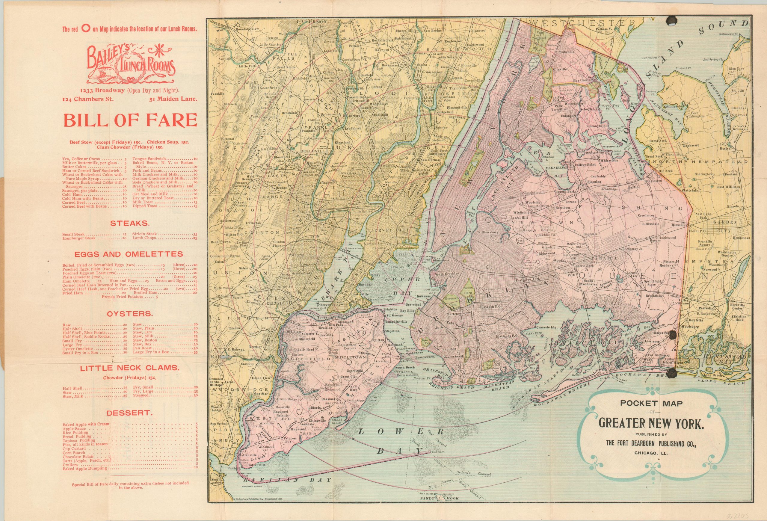
This fascinating pocket map of the Greater New York Metropolitan Area was published in Chicago in 1896 by the Fort Dearborn Publishing Company. Though the map is notable as an early example of New York City’s final boundaries, highlighted in pink (pre-dating the official 1898 consolidation), the image otherwise presents a relatively rudimentary transportation overview of the region in the late 19th century. What sets this example apart is the accompanying bill of fare for Bailey’s Lunch Rooms; found in three separate locations circled in red on the verso, which contains a detailed transportation map of Manhattan. Specialties include local seafood prepared in a variety of ways, sandwiches, steaks, eggs, and numerous desserts – everything priced at 35 cents or less. The front cover, though separated, contains blank spaces where the owner could fill in the description of a bicycle and personal information – perhaps an early form of cycling valet?