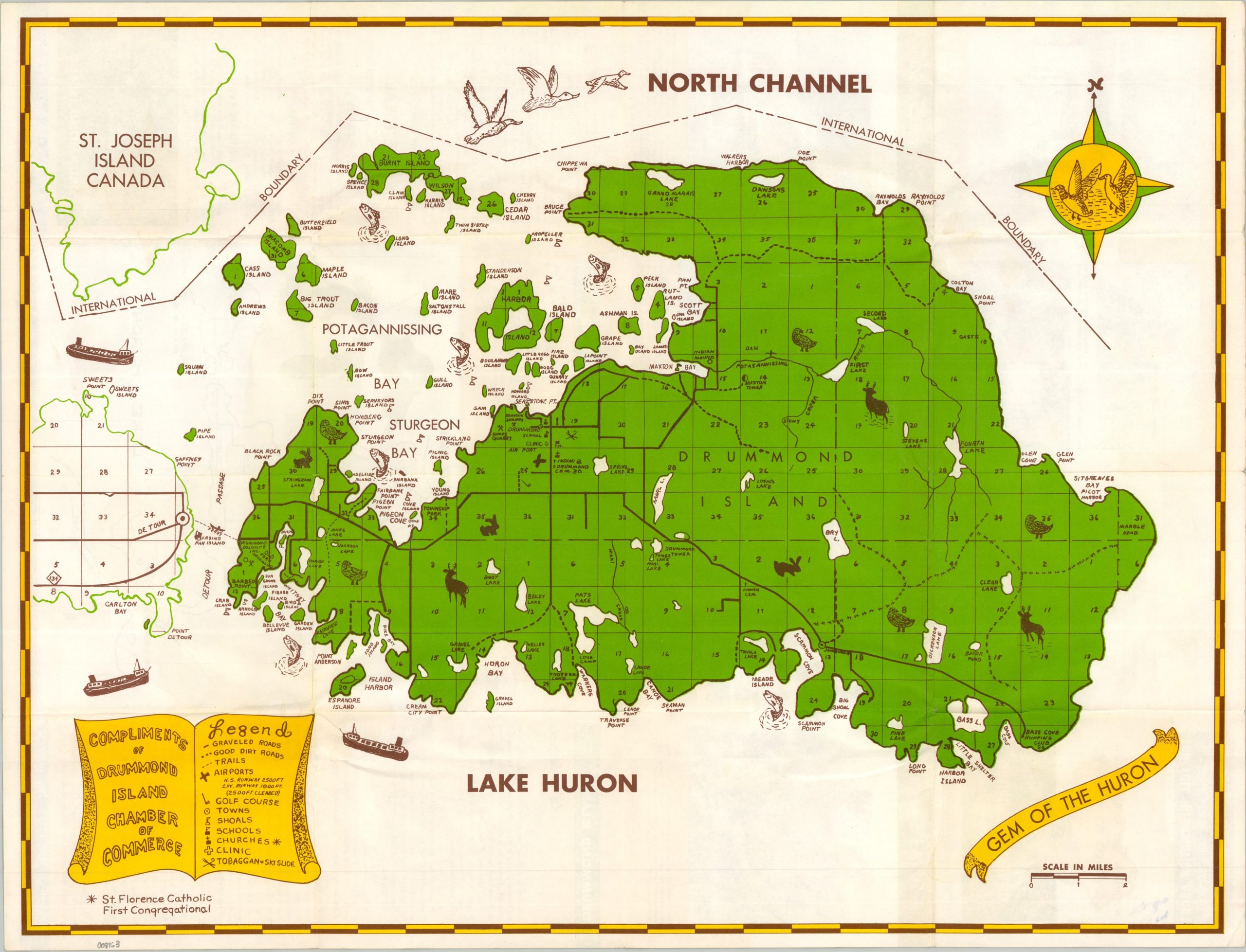
This quaint mid-century tourist map showcases all there is to see and do on Michigan’s Drummond Island, the second-largest freshwater island in the U.S. (after Isle Royale). Situated at the eastern end of the Upper Peninsula, the island is accessible only by ferry and offers an abundance of outdoor recreation like hunting, fishing, and hiking. The map shows these activities and more, along with local transportation routes, geographic features, and the nearby Canadian border. Text, photographs, and a simple map of the region are offered on the verso. Apparently, eager sportsmen could hunt coyotes from the back of a fan-powered snow sleigh!