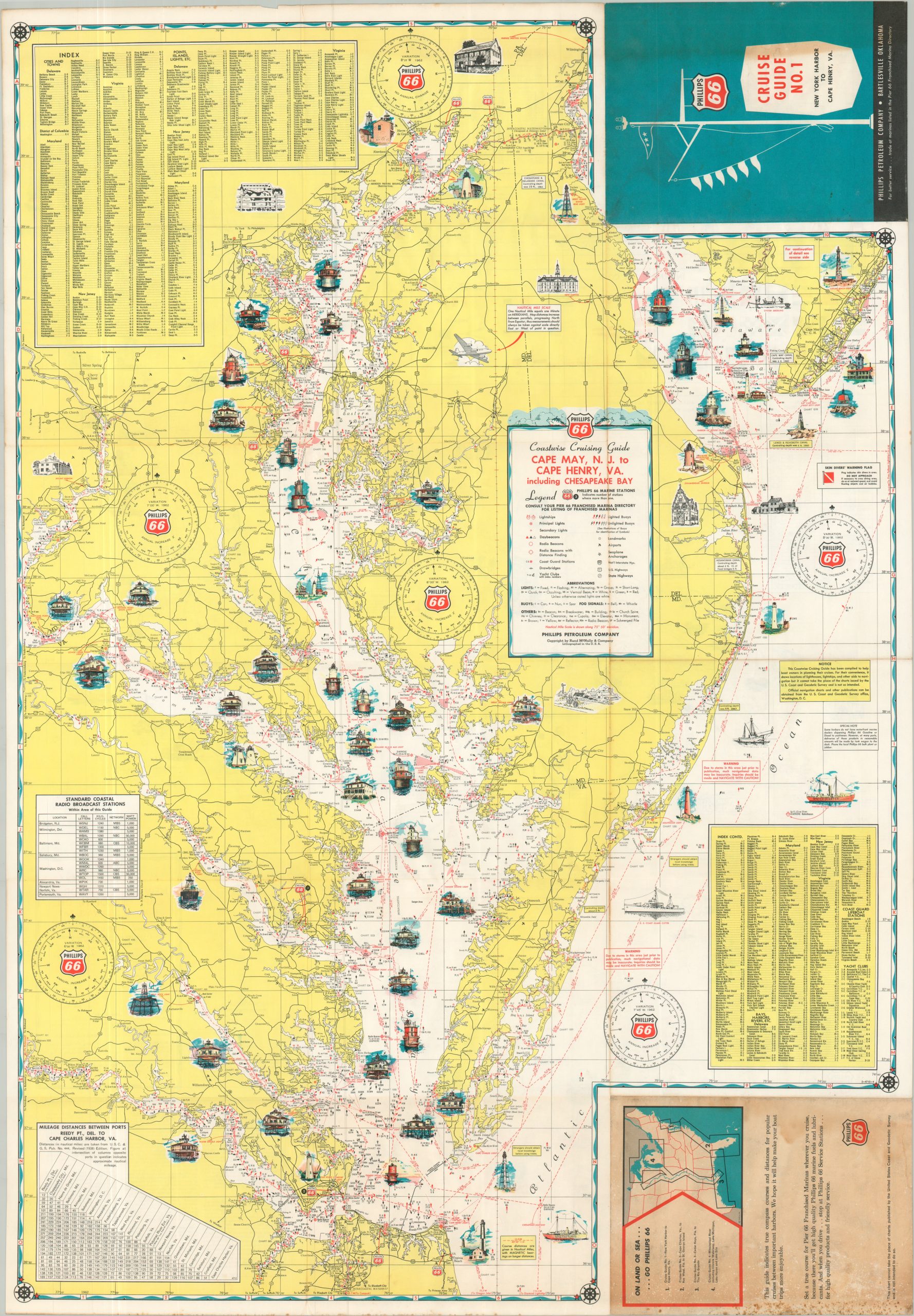
“Set a true course for Pier 66 Franchised Marinas wherever you cruise, because there you’ll get high quality Phillips 66 marine fuels and lubricants.” – Text, verso. This interesting double-sided pictorial map was one of a series of ‘Cruise Guides’ designed by Rand McNally and issued to promote the services and products of the Phillips Petroleum Company. This particular example covers the Atlantic Coast between New York and Cape Henry, with one side showing the coastline to Henlopen (including Delaware Bay), while the verso extends the content south of Cape May to the entrance of the Chesapeake Bay. Each maritime map is dotted with illustrated vignettes that showcase lighthouses, coastal architecture, and vessels of all shapes and sizes. Nautical features like beacons, buoys, radio signals, track lines, and landmarks are noted throughout, along with the locations of Phillips 66 marine stations. Safety warnings, an index of place names, mileage charts, and lists of radio stations are also provided, though a caveat warns users that the map “cannot take the place of the charts issued by the U.S. Coast and Geodetic Survey and is not so intended.”