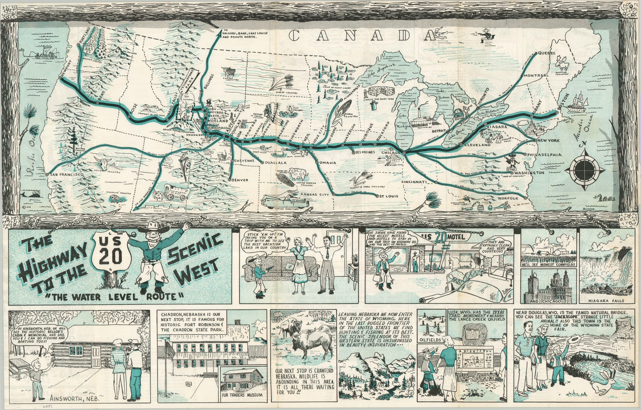
This charming 1950s pictorial map shows a simple overview of the transcontinental route of U.S. Highway 20, the longest road in America at over 3,300 miles! Connecting Boston, Massachusetts, to Newport, Oregon (with a small bit of discontinuity in Yellowstone), Route 20 was one of numerous cross-country highways available to motorists prior to the completion of the Interstate Highway System. A lack of steep hills, scenic beauty, and a direct route are among the benefits of U.S. 20, according to the pamphlet. The map is accompanied by an amusing comic strip that features a cowboy (the Kid?) kidnapping a husband and wife for a trip along U.S. 20. Despite the coercive use of a gun, the shared experiences of Midwestern cornfields, hunting Jackalopes in Wyoming, and seeing Old Faithful brought the family together by the final panel. The map was illustrated by Dunning (signed in the lower right) and copyrighted in 1959. Comics by Dunning and Sullins. Published by the Prairie Publishing Company of Casper, Wyoming. Likely sponsored by a U.S. 20 Association that spanned Nebraska and Wyoming, based on the attention given to those states and their attractions. Scarce and listed only once in WorldCat as of Jan. 2026. OCLC# 1453537870