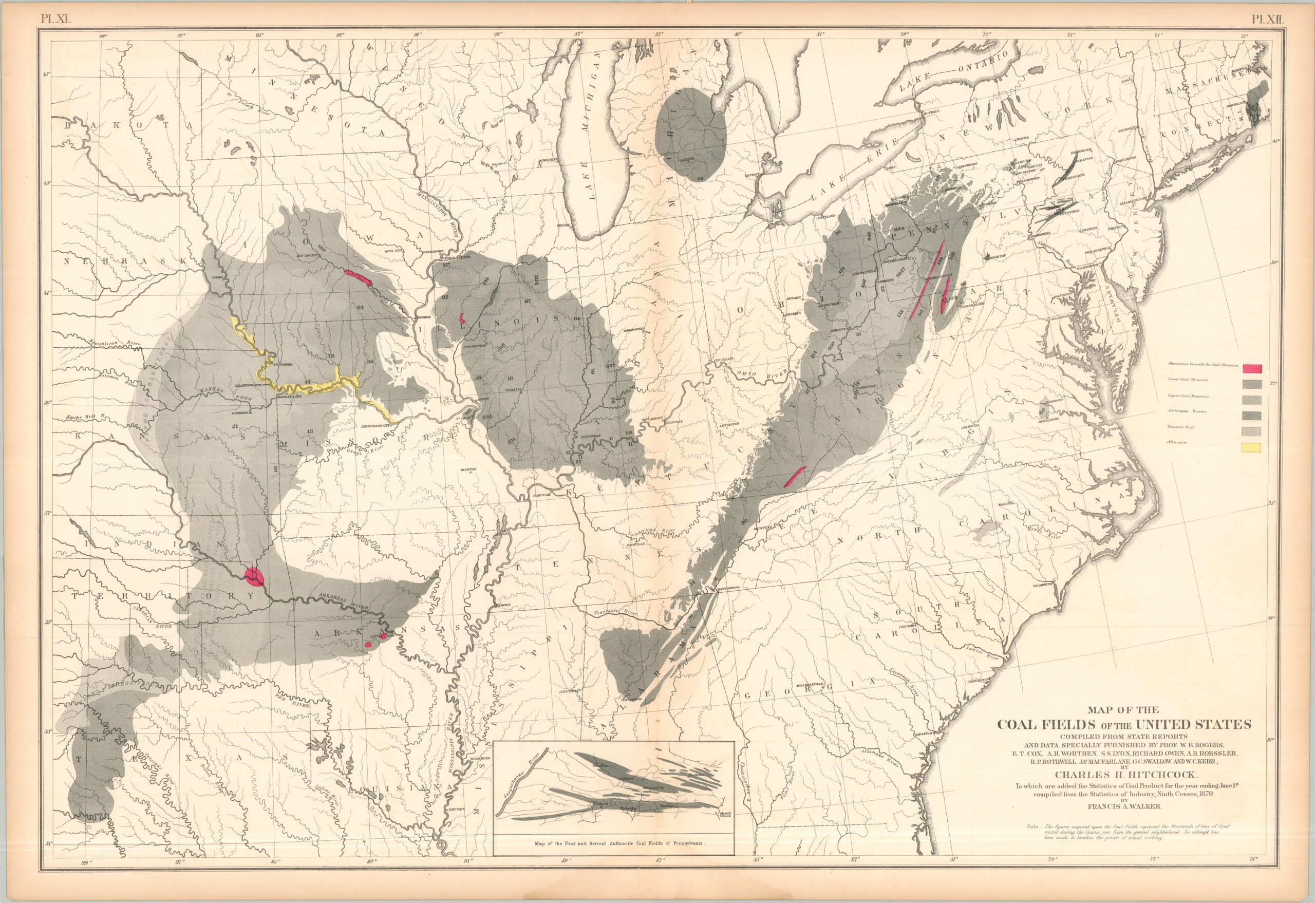
This intriguing map highlights the large coal fields discovered across the United States, from the Indian Territory to the hills of Appalachia. Upper and lower measures are depicted using shades of gray, indicating to the reader the stratification (and relative accessibility) of each coal region. Anthracite (hard coal) basins are also shown and are especially desirable for their high energy density and minimal impurities. Alluvium deposits, typically indicating exceptionally fertile soil, can be seen in yellow along the Missouri River outside of Kansas City. Despite the onset of mechanization,the public shift to sustainable fuel sources and growing concern over global warming, coal mining continues to play an important role in most of the regions depicted on this map. The map was originally issued as part of The Statistical Atlas of the United States Based on the Results of the Ninth Census, 1870, compiled by Census Superintendent Francis A. Walker. Lithographed by Julius Bien and published in 1874. The atlas serves as the ultimate 19th-century “data portrait” of a reunified nation, meticulously synthesizing geography, climate, and demographics into a visual manifesto of America’s industrial and economic potential.