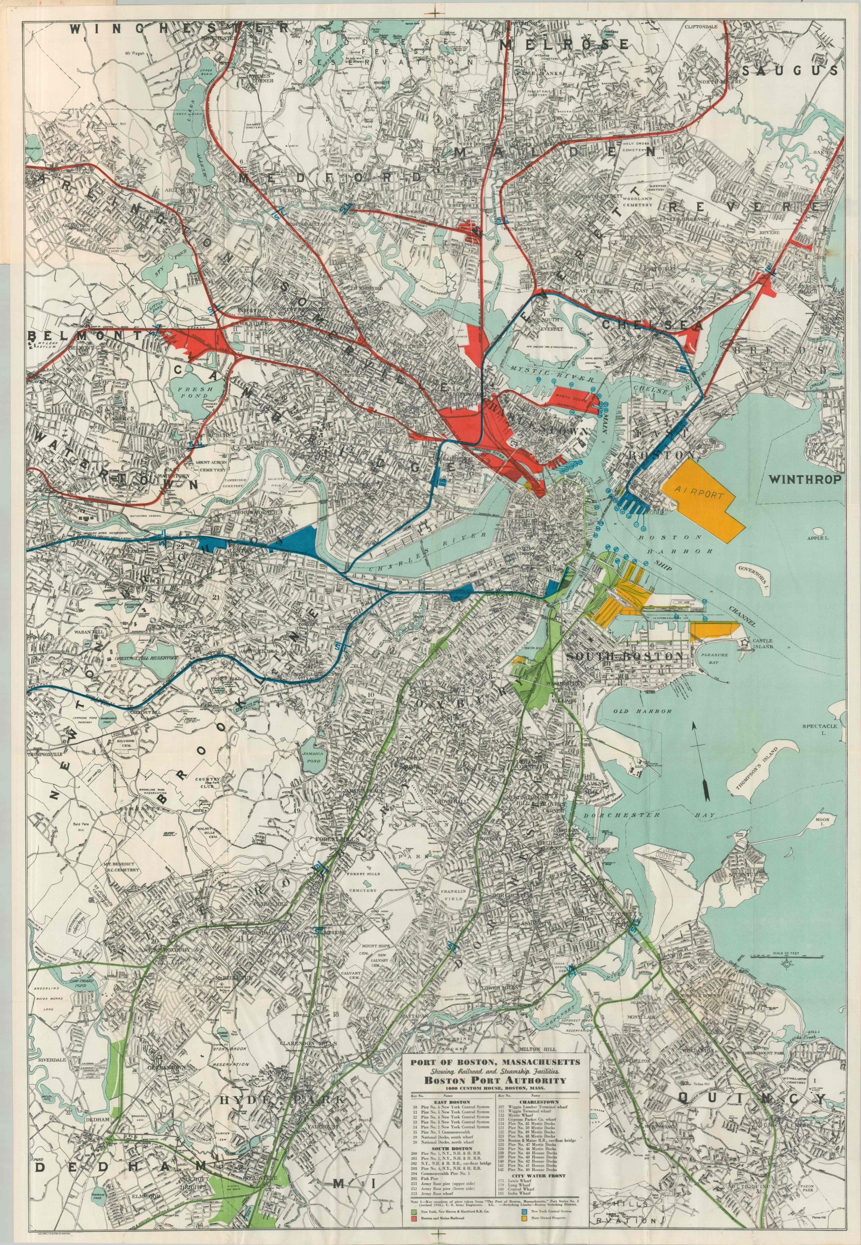
This finely detailed street plan of Boston and the surrounding cities highlights in vibrant color the transportation facilities owned by four separate entities: New York, New Haven & Hartford Railroad Company (green), the Boston and Maine Railroad (red), New York Central System (blue), and state-owned property (yellow). This interconnected system includes piers, tracks, railyards, warehouses, and more – all vital elements to the area’s industrial economy. An interesting snapshot of Boston’s commercial infrastructure in the midst of the Great Depression. The map was created by the Walker Lithograph & Publishing Company. Issued by the New York, New Haven & Hartford Railroad, most likely in 1937 (pier numbers revised the year prior).