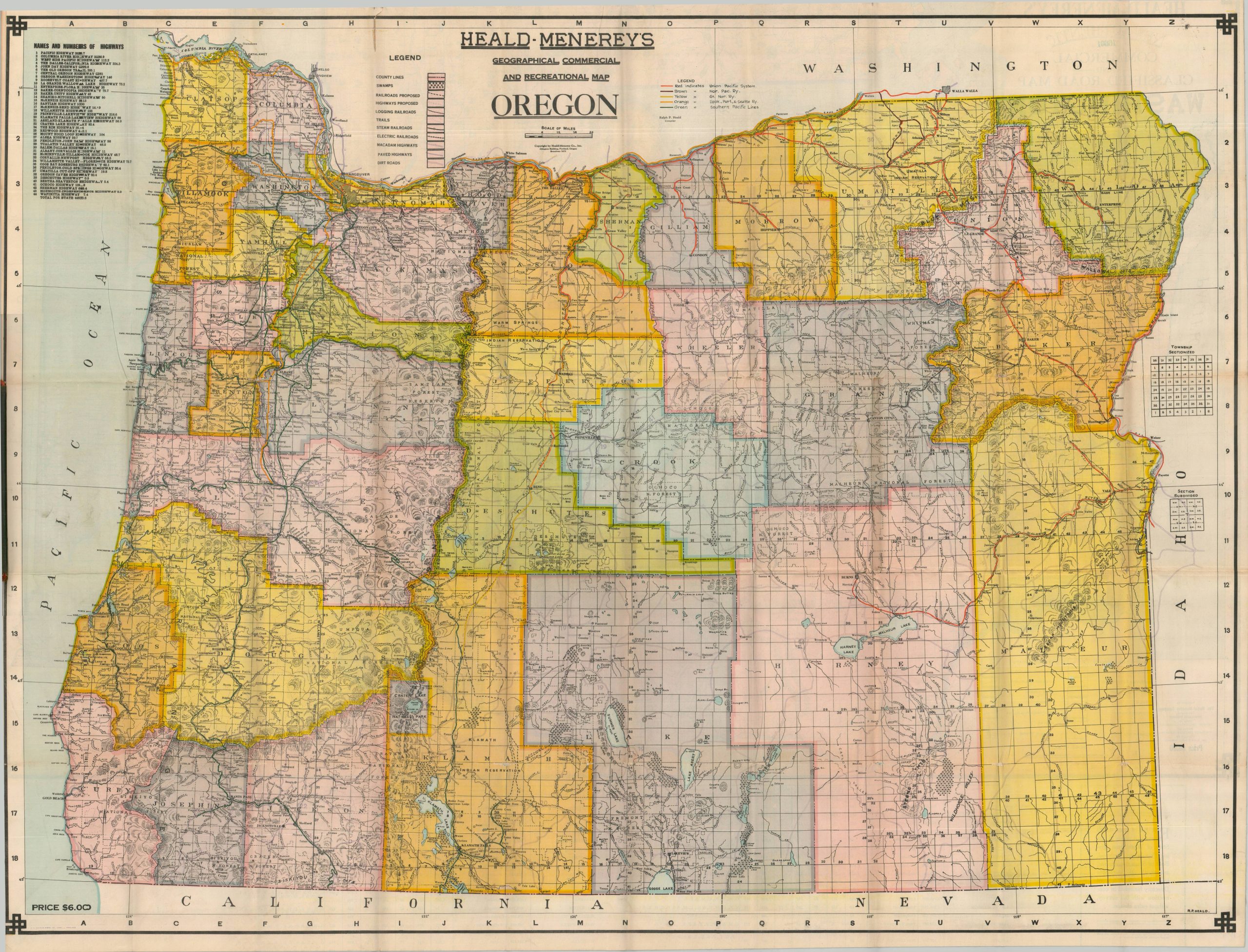
This large and detailed map of Oregon was compiled by Ralph Heald and published by the Portland-based Heald-Menery Company, Inc. around 1928, with printing performed by the F.C. Stettler Manufacturing Company. The colorful image presents a wealth of information about the Beaver State near the end of the Roaring 20s, including geography, political organization, natural resources, and transportation systems. The last category is of particular interest, as modes of transport were rapidly changing during the 1920s and thus presented a challenging feature to keep up to date. The operating lines of five different major railroads have been marked by hand in distinctive hues, including the Southern Pacific’s (green) Natron Cutoff from Eugene to Klamath Falls, completed in 1926. Logging and electric lines are also noted according to the legend in the upper left, though ownership information is absent. Auto trails were of primary importance, especially to a growing motor tourism industry – over three dozen named and marked routes are identified, totaling nearly 4,500 miles. Of particular interest are the Columbia River Highway, the Pacific Highway, and Crater Lake’s Rim Highway. Faint purple overprinting provides numbers and line styles (i.e. surface conditions) that again correspond to the legend, but the fine details can become easily lost and confused. Interestingly, Heald has not yet adopted the U.S. Numbered Highway System, which was introduced the same year as the Natron Cutoff. Despite being apparently issued somewhat regularly, the Heald-Menerey maps are uncommon on the market and in institutional collections. A price tag of $6.00 (lower left) may help explain their scarcity! WorldCat notes 3 examples of the Oregon state map in two different listings. The copy at the Huntington is slightly different, so the others might have some variations as well. Sources: OCLC# 228733736, OCLC# 21838566, Example at The Huntington