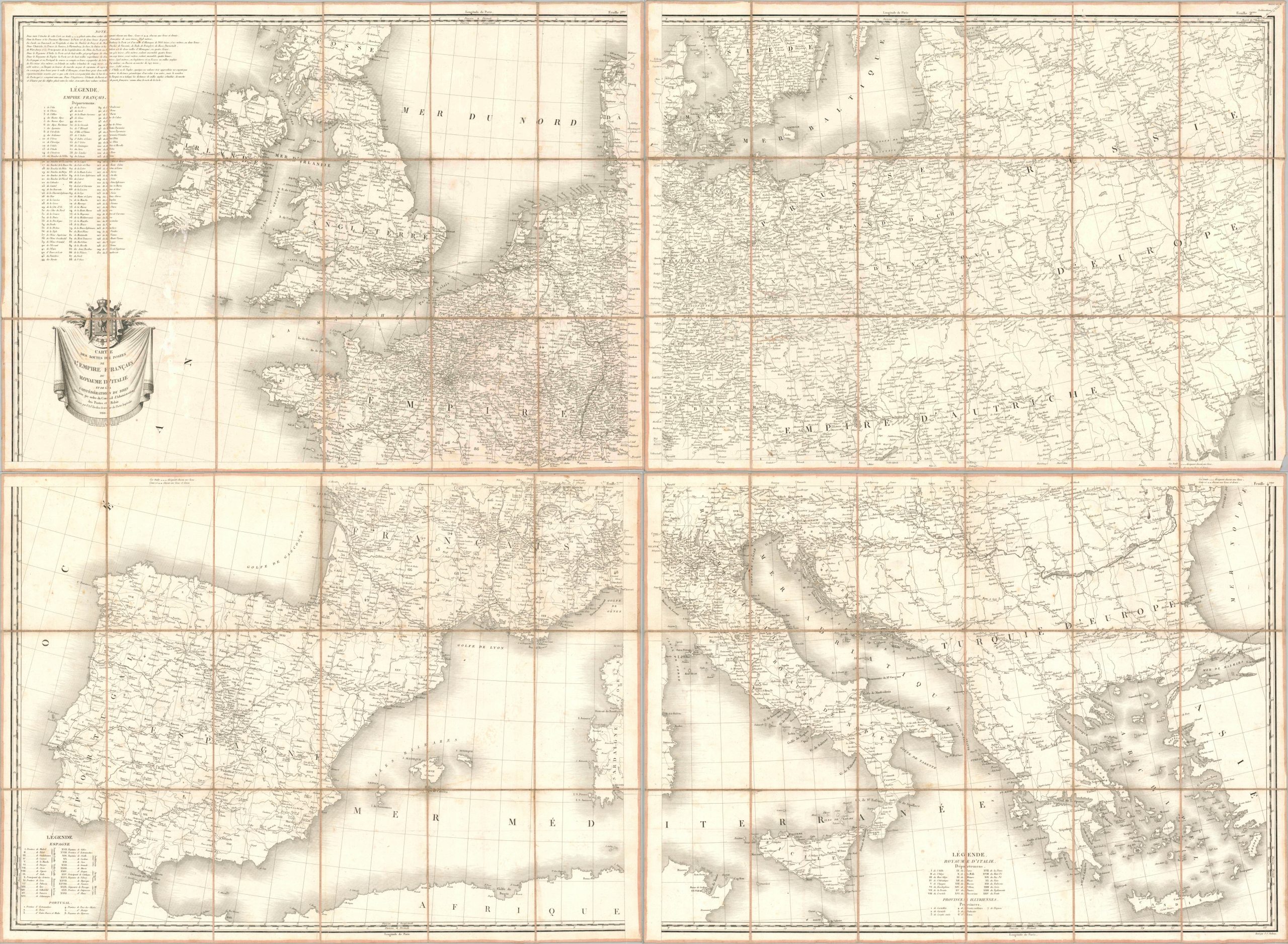
This massive postal map of Europe presents the road network of the continent near the height of the First French Empire under Napoleon Bonaparte. The carefully engraved image conveys a sense of authority and efficiency from the Atlantic Ocean to the Black Sea and beyond, and from the North Sea to the Mediterranean. Distances between points can be easily measured using two styles of lines or the numbers conveniently posted. The client states of Spain, the Illyrian Provinces, the Duchy of Warsaw, the Kingdom of Italy, and the short-lived Confederation of the Rhine exist harmoniously within the Empire of France. Various political regions (departments and provinces) are numbered and named using three different legends. Compared to the empires of Russia and Turkey, the network of post roads is extremely robust. The image was engraved by Pierre Anthony-Francois Tardieu and published in Paris by Charles Piquet in 1814. Issued by the French Administrative Council of Posts and Relays. The perception of stability is misleading, as two years prior to issue Napoleon’s disastrous retreat through Russia led to a significant reversal in fortunes. The War of the Six Coalition came to an end in May 1814 and many of the states on the map would soon have the borders and titles changed once more.