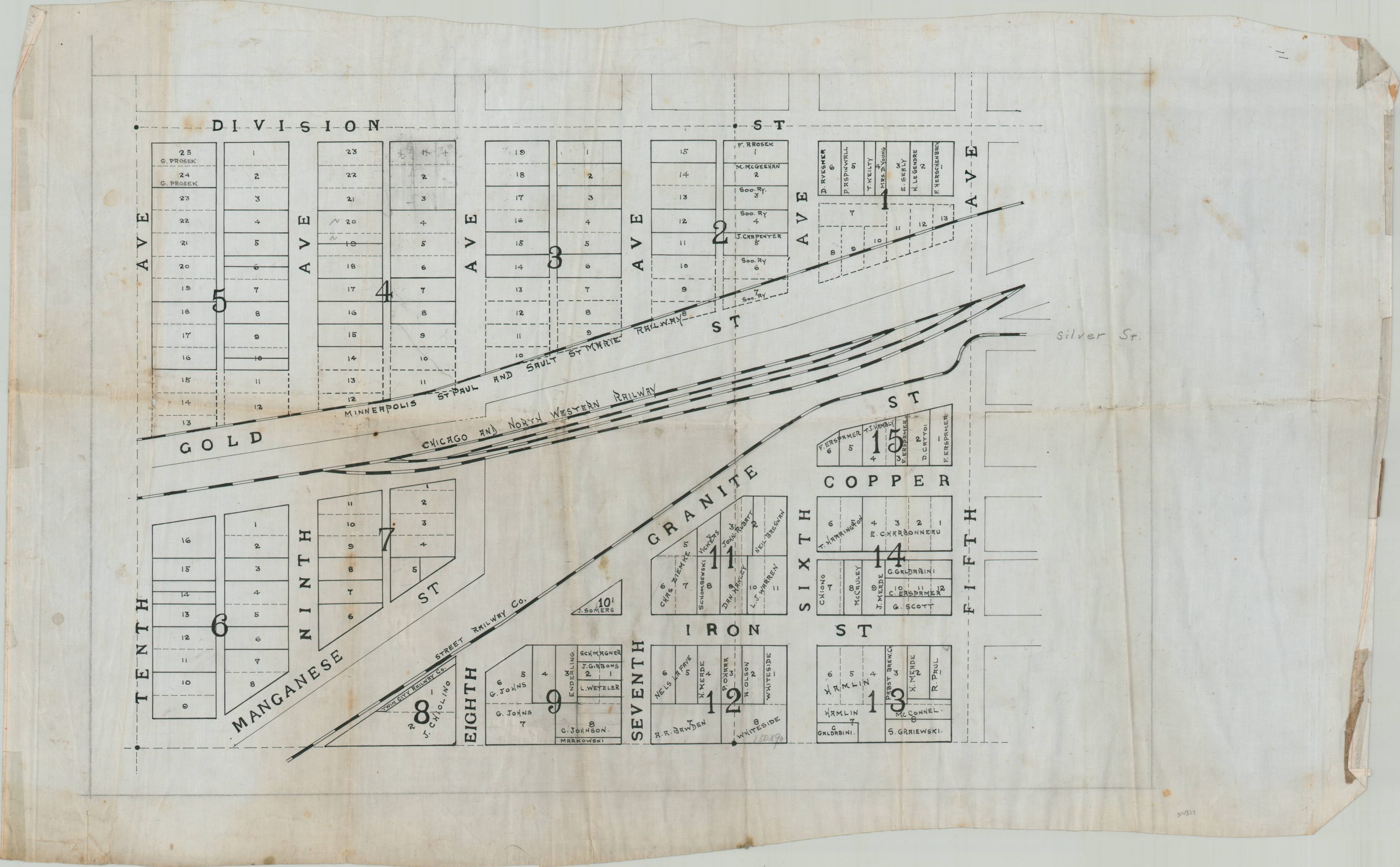
This unusual hand-drawn plan shows approximately six square blocks running through the center of Hurley, a town situated in northern Wisconsin on the border with the Upper Peninsula. Owner’s names are identified in several of the plotted lots, mainly those in the south and east. The street names reflect the town’s mining history; with gold, manganese, iron, granite, and copper all represented. Lines of the Minneapolis, St. Paul, and Sault St. Marie Railway, Chicago and Northwestern Railway, and the street railway are all labeled. The last, which ended operation in 1932, helps to date the anonymous manuscript to likely sometime during Prohibition. At the time, the town was a notorious haven for vice. It “had many saloons, was plagued by prostitution and gambling, and was known as the hellhole of the range” according to the Society of Architectural Historians. Source.