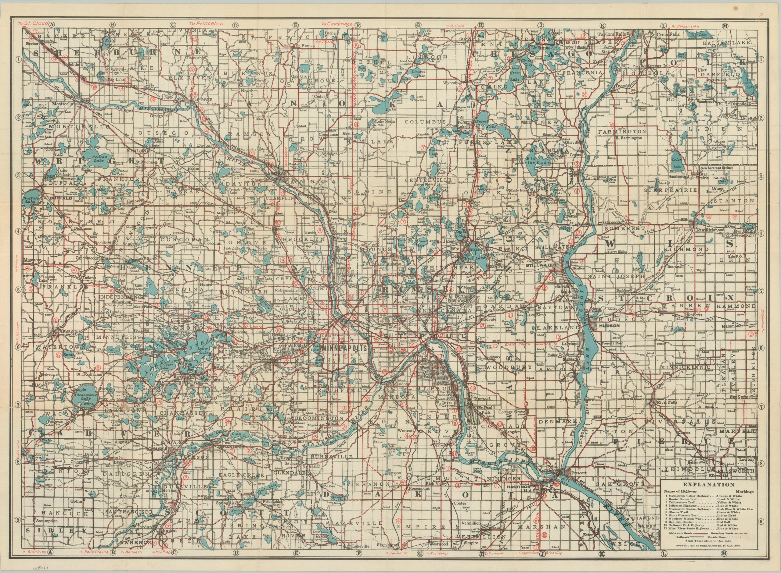
“30 Miles Radius Showing State Trunk Highways, Registered Trails, and County Roads to All Lakes.” – Front cover. The popularization of the automobile and the introduction of improved road networks during the early 1920s ushered in a new era of leisure for the (mostly upper-class) American. Rigid railroad timetables and limited destinations were a thing of the past for the urban motorist, who had always looked for ways to escape the noise, smoke, and congestion of the city in favor of outdoor recreation and natural scenery. This map of the area around St. Paul and Minneapolis reflects this tourism trend well. Primary and secondary auto routes across an approximately 30-mile radius are noted with solid and dashed red lines, respectively. Issued before the era of numbered highways, the legend (lower right) identifies the eleven named trails within the image, as well as their respective markers (generally posted on utility poles). The ‘Land of 10,000 Lakes’ moniker is well deserved, as numerous bodies of water are labeled and shaded in a soft blue. Schools, railroad lines, and settlements of all sizes are among the other various features. Popular destinations, at the time, included Stillwater, Lake Minnetonka, Taylors Falls, and White Bear Lake. The map was copyrighted in 1922 and published by the McGill-Warner Company of St. Paul. Scarce on the market and in institutional collections. Though the sheet itself has no title, the front cover (Twin Cities Auto Guide Map) does not appear in WorldCat as of December 2025.