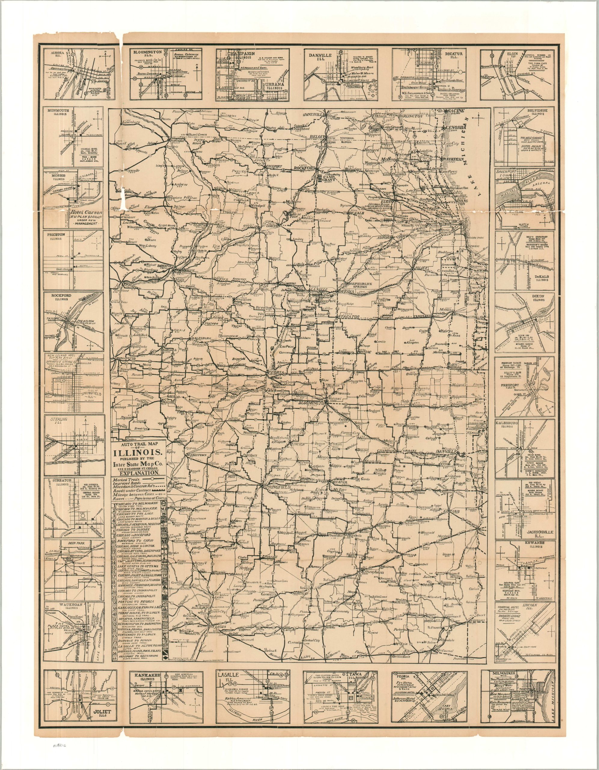
Before there were highways, there were auto trails. This 1920 map of Illinois and the surrounding area highlights the embryonic road network from southern Wisconsin to St. Louis. Marked trails are shown with the boldest lines, with the enclosed numbers referencing the named routes in the lower left. These were not government-sponsored (for the most part), but rather were supported by private organizations that functioned much like modern-day chambers of commerce. Each trail promoted its amenities, paved surfaces, directness, etc. Corresponding signage (note the small images in the key) was posted along utility poles. The somewhat stylized image also notes other improved roads, macadam & concrete, and those currently under construction. Population of cities and distances between points are faintly noted throughout. The border is comprised of small street plans of thirty cities, mostly in Illinois. These show the primary thoroughfares and promote specific restaurants, retailers, garages, and hotels – an uncommon example of early travel marketing in the Land of Lincoln. The map was drawn by W.S. Demorest (named faintly along the bottom edge). Published in 1920 by the Inter-state Map Company of Chicago. WorldCat lists a Official highway & auto trail map of Illinois, Wisconsin, Michigan, and Indiana made by the firm the same year (OCLC# 1371503820), but this more focused example appears to be otherwise unrecorded.