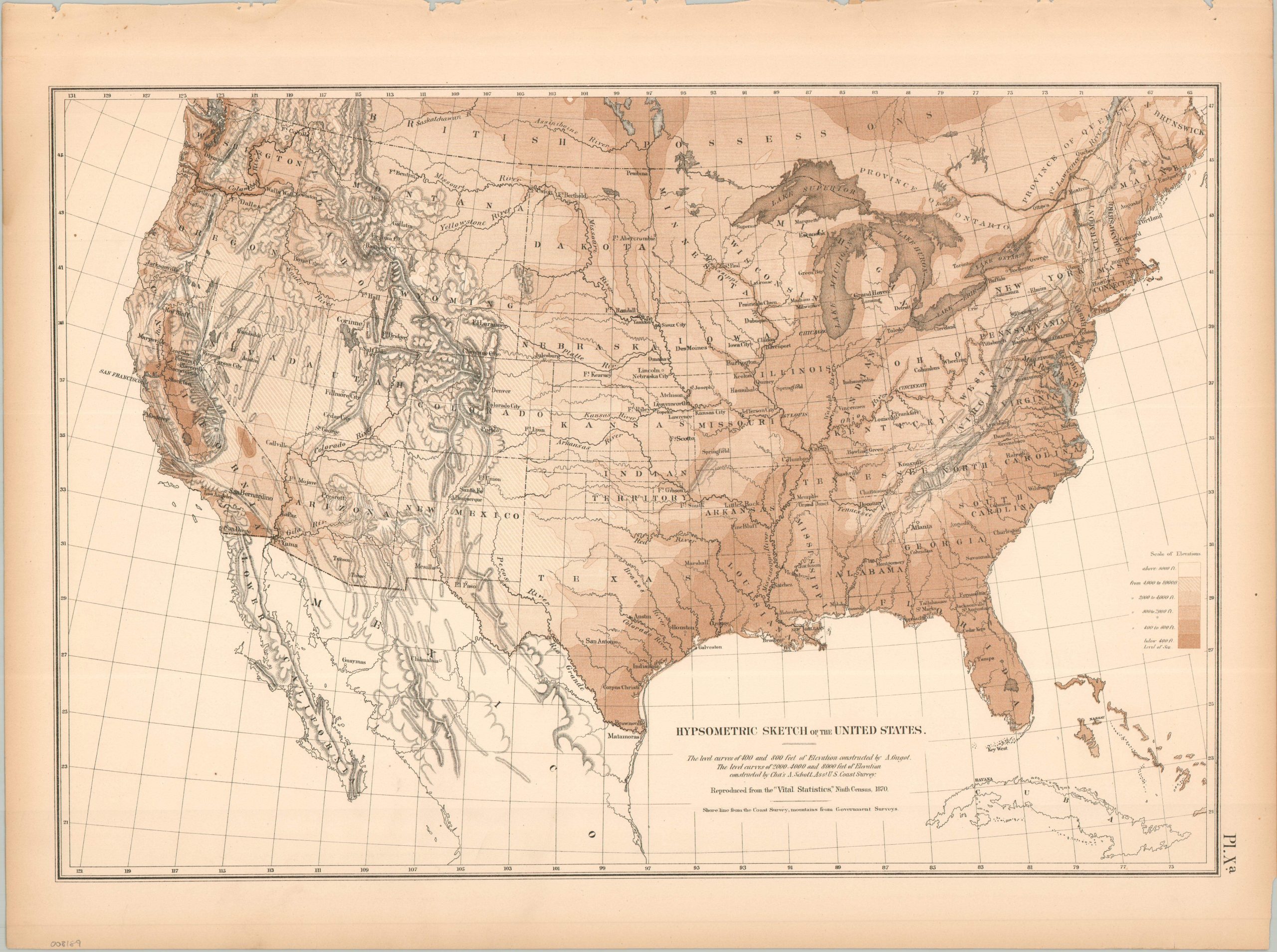
Rather than using contour lines or numerical indications, this hypsometric map uses shades of brown to generalize the elevation above sea level for the continental United States. The white areas (only a few) are above 8,000 feet, while the darkest regions sit 400 ft. or below. Simple hachures reflect mountain ranges. Interestingly, the highest and lowest points are only 85 miles apart (Mt. Whitney and the Badwater Basin in Death Valley, respectively). The map was originally issued as part of The Statistical Atlas of the United States Based on the Results of the Ninth Census, 1870, compiled by Census Superintendent Francis A. Walker. Lithographed by Julius Bien and published in 1874. The atlas serves as the ultimate 19th-century “data portrait” of a reunified nation, meticulously synthesizing geography, climate, and demographics into a visual manifesto of America’s industrial and economic potential.