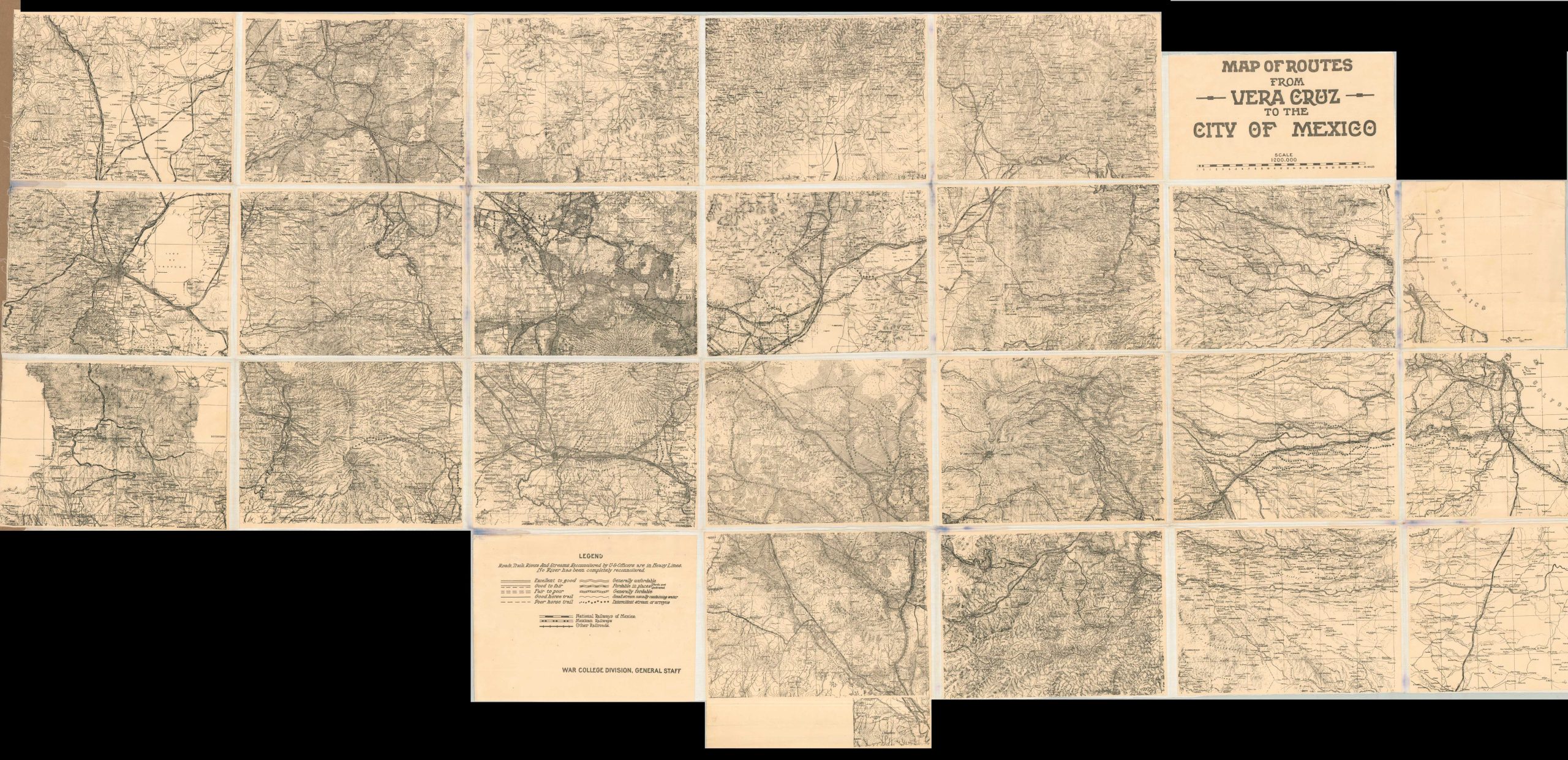
This marvelously detailed topographic map covers a large area in central Mexico between the port city of Vera Cruz and the capital of Mexico City. It was compiled and published by the U.S. General Staff War College Division, most likely for use in training or planning exercises during the early 1910s – the tumultuous period of the Mexican Revolution. The image presents a number of overland paths reconnoitered personally by Army officers, at least according to the text in the lower left. Transportation is the focus of the content, with various qualities of roads, horse trails, and fordable waterways identified with different lines. Routes of the National Railways of Mexico, the Mexican Railways, and others are also shown. Though the map is undated, the orientation of the railways and the political context of the Mexican Revolution indicate a probable date of around 1910-1915. It may have been issued in conjunction with The Tampico Affair, when the U.S. military captured Vera Cruz in response to the temporary detainment of American sailors by the Mexican government of Victoriano Huerta (who gained power via a coup d’etat in 1913). The seven-month occupation would have been a prime opportunity for the reconnaissance efforts depicted within the image. General Winfield Scott made a similar advance from Vera Cruz to Mexico City during the Mexican-American War nearly 70 years earlier. The map is a rare example and not often seen on the market (this is the first example I’ve handled). Only two examples are noted in WorldCat as of March 2025 (albeit on sheets of slightly different sizes) – the University of Chicago Library and the UC Northern Regional Library. The corresponding entry notes a conjectural date of 1910. Sources: OCLC# 33050524; University of Chicago; Emerson Kent; U.S. Navy History; Council on Foreign Relations;