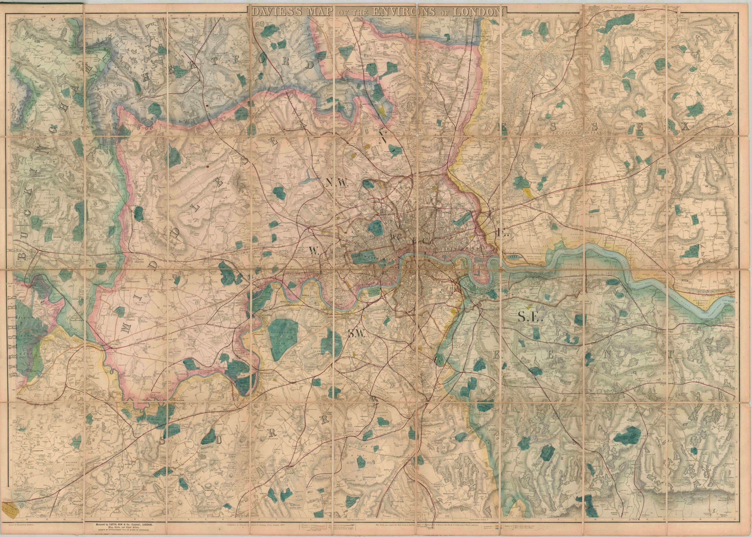
This tremendous folding map of London and the surrounding area was drawn and engraved by Benjamin Rees Davies and published by Edwin Stanford in 1870. Mounting was performed by the map-selling firm of Letts, Son & Co, with the front cover featuring the company’s logo prominently. At the time of issue, the ‘Big Smoke’ was expanding rapidly outward and developing its characteristic identity as a diverse metropolis situated at the heart of Britain’s Empire. The city center is depicted in some detail, with major streets labeled and shown crisscrossing the urban congestion of the largest city in the world (at the time of publication). Individual buildings are outlined in the outskirts, and a handful of prominent locations and landmarks are named. As one heads away from the city, place names reflect prominent estates, small villages, castles, and local industries. Several circles radiate from the center of the image indicating 4 miles from Charing Cross, plus 3 and 12 miles from the Post Office. Lines explaining each are outlined in the key at the bottom of the page. This legend also explains the original hand color, which highlights parks (green) and cemeteries (yellow) – both popular public areas for outdoor recreation. Railways, both in operation and under construction, are also shown. Topography is depicted in hachure, while other features like forests and commons are depicted pictorially.